P. 35 YERUPAJA (6634m) CARA OESTE/WEST FACE
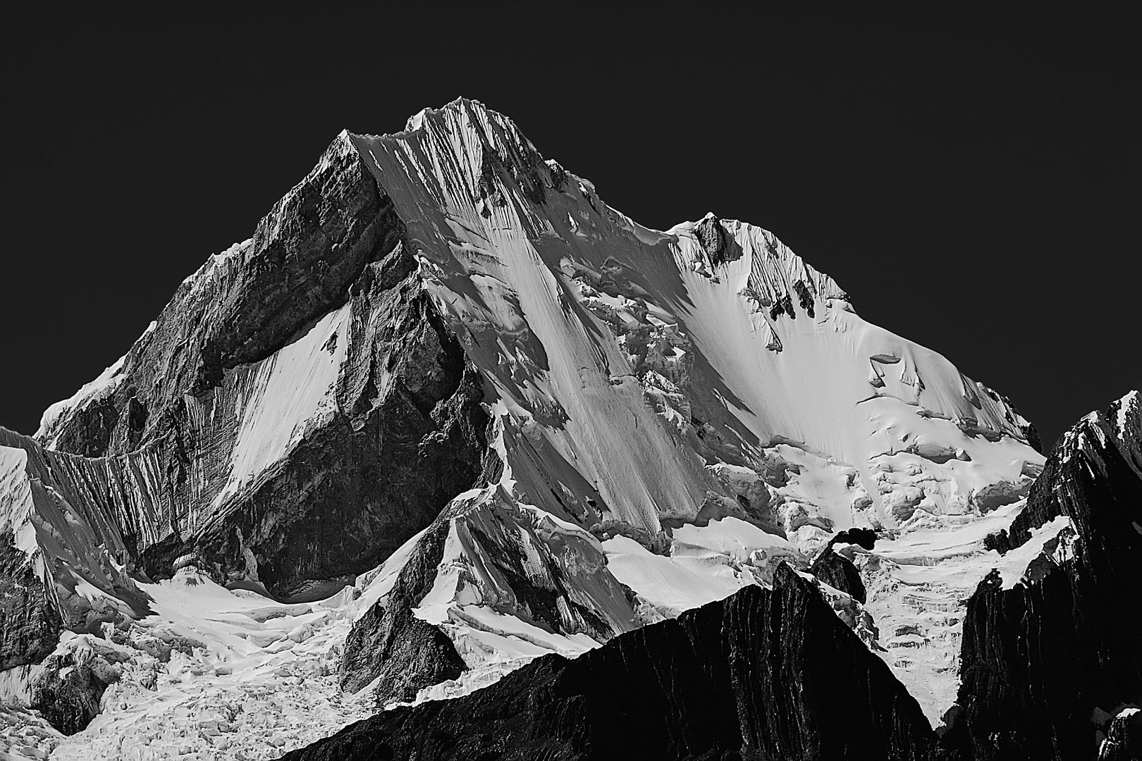
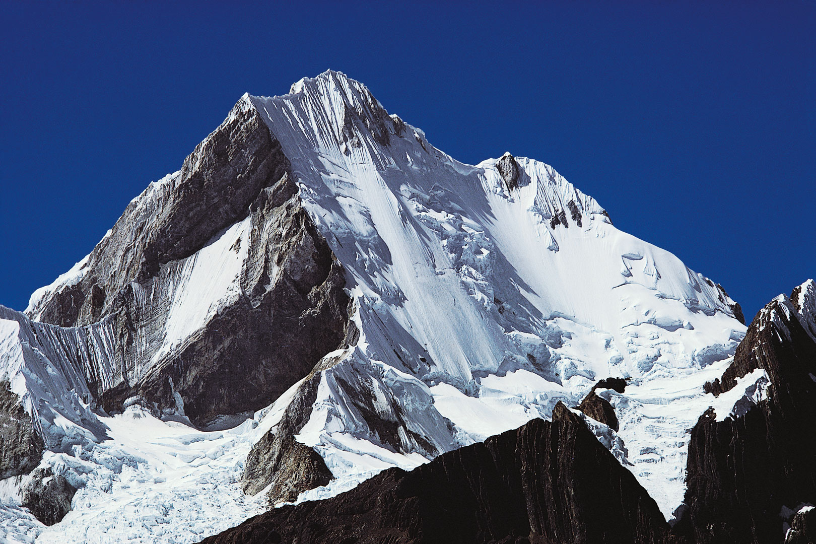
Donde fue tomada: Desde el Paso Minapata, el paso entre los valles de los ríos Achín (Jahuacocha) y Llamac en la franja norte de la Cordillera.
Where it was taken: From Paso Minapata, the pass between the Jahuacocha and Llamac Valleys on the northern edge of the Cordillera.
Como llegar: Un camino parte la vertiente norte del valle entre Lagunas Jahuacocha y Solteracocha y asciende al Paso Minapata. Desde el norte una Carretera rústica y un camino de herradura asciende desde la Mina Pallca en el valle del río Llamac (entre Pocpa y Cuartel Huaían en la carretera a la punta de partida del circuito). El camino atraviesa propiedades de la mina, así el acceso puede estar restringido en algunas fechas.
How to get there: A trail starts up the northern slope of the valley between Lagunas Jahuacocha and Solteracocha and climbs to Paso Minapata. A dirt road and trail climbs south from the Pallca meadow in the Rio Llamac Valley (between Pocpa and Cuartel Huaían, on the road most people take to start the circuit). However this road cuts through parts of the Pallca/Mitsui mine, and access may be restricted at times.
Páginas relacionadas/Related pages: 9, 27, 31-32, 34