P. 32 GLACIAR: RONDOY (5879m) & JIRISHANCA (6094m)
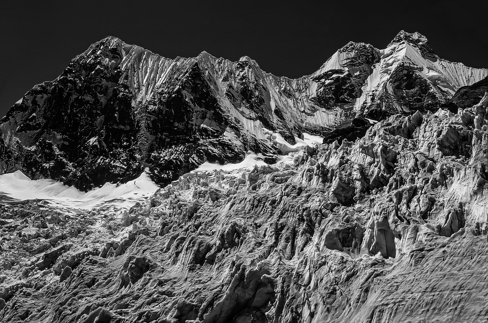
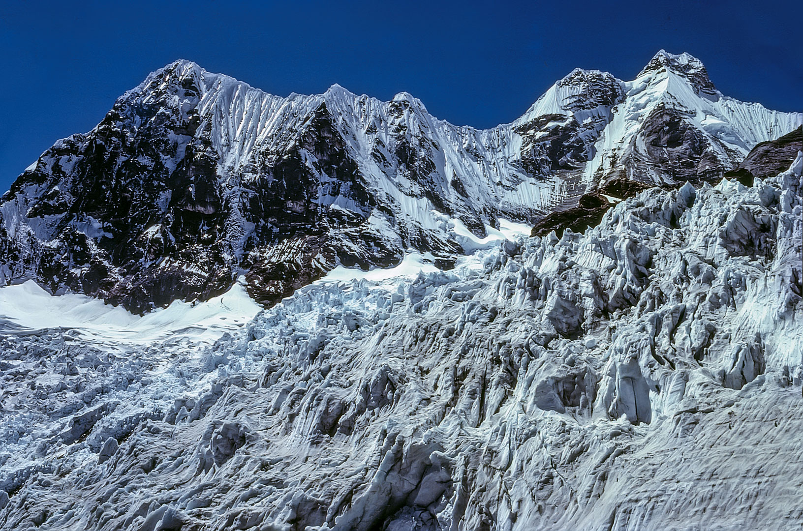
Donde fue tomada: Desde el glaciar al pie de la cara oeste del Yerupajá.
Where it was taken: From the glacier below the west face of Yerupajá.
Como llegar: Un camino muy accidentado asciende a la ladera derecha (sur) de Laguna Solteracocha y traviesa 150m encima de la laguna. Luego voltea a la derecha y asciende por un sendero muy empinado al glaciar. Es una ruta difícil, rocosa en gran parte, no es un camino establecido.
How to get there: A rough trail climbs to the right (south) of Laguna Solteracocha and traverses high above the lake. Then it turns to the right and climbs steeply to the right of the glacier before finally ending beside the large icefield. This is a rough path, often rocky, not an established trail.
Páginas relacionadas/Related pages: 9, 27, 29-32, 34-35, 39