P. 23 PASO SAN ANTONIO: RASAC (6017m), YERUPAJA (6634m), SIULA (6344m, & CARNCERO (5975m), 2024
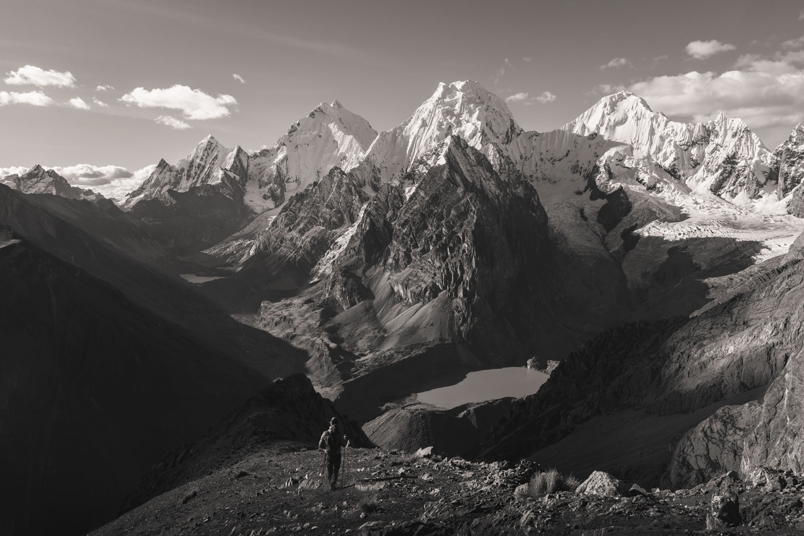
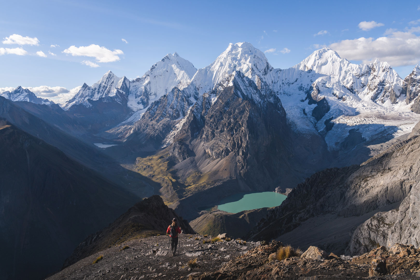
Foto: Matt Stacy
Donde fue tomada: Desde Paso San Antonio, entre la Quebrada Guanacpatay y el Río Calinca en el sur de la Cordillera.
Where it was taken: From Paso San Antonio, between the Quebrada Guanacpatay and the Río Calinca near the southern end of the Cordillera.
Como llegar: Se atraviesa el Paso San Antonio por un camino accidentado que atraviesa el cerro al norte de la Quebrada Guanacpatay para descender a la zona del río Calinca y las Lagunas Jurau y Sarapococha. Tecnicamente no es parte del circuito tradicional, pero hoy en día la mayoría de caminantes lo utilizan.
How to get there: The Paso San Antonio is reached via a rough trail north from the Quebrada Guanacpatay in the southern end of the range. The steep trail then descends to the Rio Calinca region near Lagunas Jurau and Sarapococha. This is not technically on the main circuit, but most hikers now take it.
Páginas relacionadas/Related pages: 22, 24-26