P. 13 HUARAZ & CORDILLERA BLANCA, 1980s
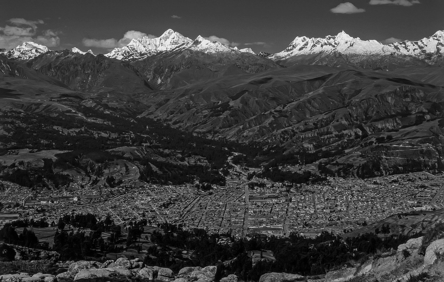
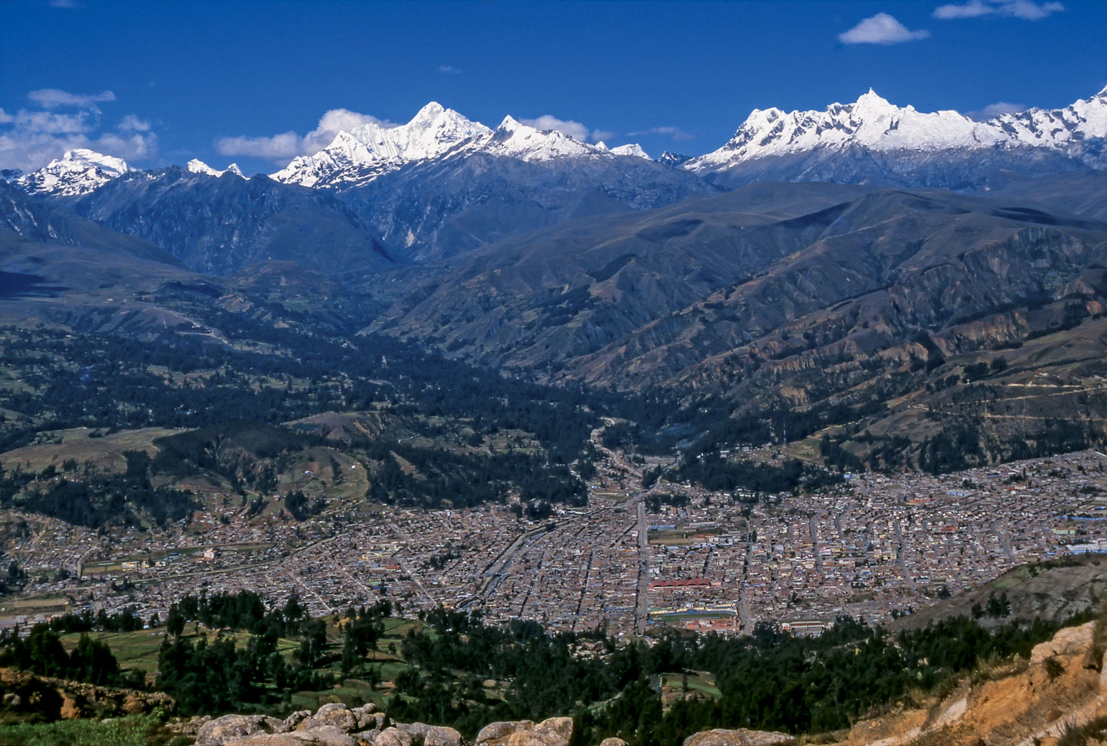
Donde fue tomada: Desde el Km. 4 de la carretera a la Cordillera Negra desde Huaraz hacia Punta Callán y Casma.
Where it was taken: From about Km. 4 on the highway west from Huaraz toward Punta Callán and Casma.
Como llegar: Una carretera excelente cruza el río Santa al oeste de Huaraz, pasa por el distrito caótico de Los Olivos, y asciende por la Cordillera Negra hacia el abra de Punta Callán. Los panoramas de Huaraz (algo cambiado desde los años 1980) y la Cordillera Blanca son excelente desde el momento la via sale de la ciudad. Hay varias clases de transporte en ambas direcciones, tnato omnibuses desde la costa y colectivos a los pueblitos aledaños.
How to get there: An excellent highway crosses the Rio Santa west from Huaraz, passes through the chaotic Los Olivos district, and winds up the Cordillera Negra to the pass at Punta Callán. The views of Huaraz (a bit changed since the 1980s) and the Cordillera Blanca are excellent from the moment the road leaves the city. There are various types of public transport in both directions, both buses going to and from the coast and colectivos going from village to village.
Páginas relacionadas/Related pages: 3, 52-53, 55-57, 63